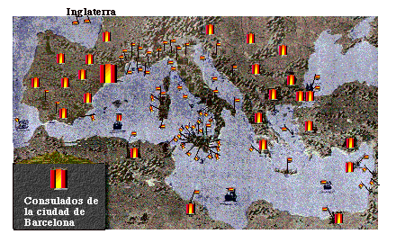
This map, drawn between 1300 and 1350, shows Catalunya (the largest flag is in Spain) and its and embassies around the Mediterranean and part of England. (This picture has been enhanced following the original's colorings and outlines)